
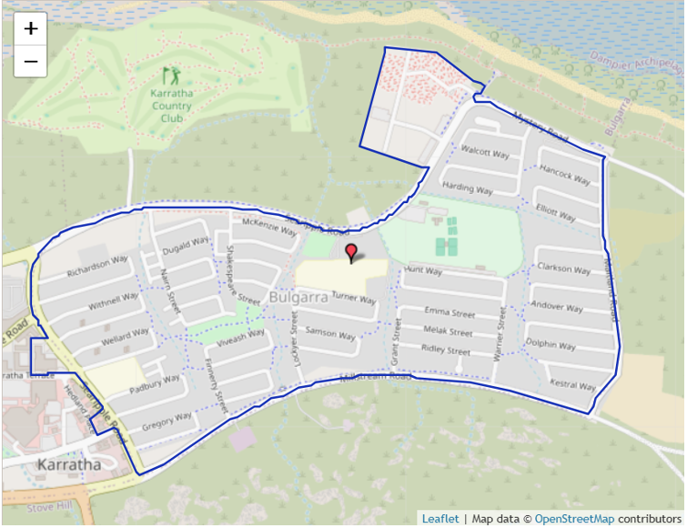
The following defines the local-intake area of this school:
KARRATHA PRIMARY SCHOOL (5535) (Government Gazette Dec 2010)
The local-intake area of this school is defined by the following two areas:
From the junction of Millstream Road and Searipple Road, north along Searipple Road (both sides included) to Warambie Road, north east along Searipple Road (east side included) to Corral Road, east along Searipple Road (both sides included) to Mystery Road, east along Mystery Road (both sides included) to Maitland Road, south along Maitland Road (both sides included) to Millstream Road and west along Millstream Road (north side included) to Searipple Road.
The Karratha Industrial Estate is included within the local intake area of this school.